Volcano Live
volcanolive.com
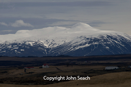
Hekla Volcano | John Seach

Iceland
63.98 N, 19.70 W
summit elevation 1491 m
stratovolcano
Hekla Volcano is located in southern Iceland 110 km east of Reykjavik, and 55 km from the coast. Hekla is the most active volcano in Iceland, and one of the world's best known volcanoes.
Hekla volcano, Iceland - John Seach
The structure of Hekla is considered intermediate between crater row of Laki-type, and stratovolcano of the Vesuvius-type. It is built on a 5 km long fissure. Repose periods at the volcano have lasted from 10 to 102 years.
The magma reservoir feeding Hekla is located at a depth of 5-9 km. During non-eruptive periods the volcano is virtually aseismic. Eruption-related seismicity starts only 30-80 minutes before its onset. Hundreds of small volcano-tectonic earthquakes (magnitude < 3), related to the intrusion of magma, occur during the first hours, when the eruption is violent and explosive.
Since 1970, Hekla volcano has erupted about every 10 years. The initial phase of each Hekla eruption is always highly explosive. The duration and magnitude of the
explosive phase is directly correlated with the length of the preceding repose period.
2013 Unrest
A level of uncertainty was declared at Hekla volcano on 26th March 2013 due to an increase in sesimic activity.
2000 Eruption
Changes in groundwater table were observed up to 2 years before the eruption started. A short-lived but intense eruption of Hekla volcano began on 26th February 2000, and lasted for 12 days. A 6.6-km-long fissure opened along the length of Hekla volcano from the SW to the NE, south of the summit area. A Subplinian eruption plume reached a height of 12 km in 32 minutes. This was accompanied by several small pyroclastic flows. Volcanic activity at Hekla changed to fire fountaining and then to Strombolian, ending with a quiet effusive lava phase.
1991 Eruption
An eruption started at Hekla volcano at 5 p.m. (UT) on 17th January 1991.The eruption column reached a height of 11.5 km in 10 minutes. Ten hours after the start of the eruption, an eruption plume extended 300 km from the volcano. During the first few hours of the eruption, lava fountains rose to a height of 300 m. By the second day of the eruption, the activity was already more or less restricted to a single fissure on the lower south flank trending southeast from the summit of Hekla. Effusion of lava was strongest in the first 11 hours of the eruption. During the first couple of weeks, a single lava flow effused from the crater. Subsequently, however, it flowed in a tube for a few hundred metres from the crater and then to the surface through five vents. Lava flows covered 23 sq km. The eruption declined on 23rd February 1991. Like the 1970, and 1980-81 eruptions, the 1991 eruption at Hekla issued from flank fissures rather than the summit fissure.
1980-81 Eruption
On the day of the eruption, campers 10 km north of Hekla noticed a sulphur smell, and birds (geese and golden plovers) were restless. The eruption began at Hekla volcano on 17th August 1980 with a plinian phase and simultaneous emission of lava from a fissure along the Hekla volcanic ridge. The eruption began at 13:25 or 13:30 hr, and by 14:00 hr the eruption column reached a height of 15 km. The eruption rate declined rapidly after the first day and the eruption stopped on 20th August. The August 1980 eruption at Hekla came without warning. No earthquakes had been found to originate in the vicinity of the volcano for at least several years, in spite of a relatively dense seismograph network near the volcano. Like the 1970 eruption, the 1980-81 eruption at Hekla issued from flank fissures rather than the summit fissure.
1970 Eruption
The 1970 eruption at Hekla was unusual up until this time, because it occurred from the flank and base of Hekla ridge, rather than the usual main fissure system.
On 5th May 1970 earthquakes up to magnitude 4 were registered at Reykjavik. Several hours before the earthquakes started, dog were restless at Burfell hydropowerstation, 15 km NW of Hekla. The eruption began at 21:23 hr when fissures opened up nearly simultaneously on the SSW and W flanks of the Hekla ridge. Two craters opened up on the SSW-flank, at an elevation of 800 m, followed by a third crater at 780 m. A 1000 m high lava fountain erupted from the third crater at 22:30 hr.
A little over an hour after the eruption started in the SW part of Hekla, an eruption began NNE of the Hekla ridge, at a distance of 7 km from the first eruption site. Fluorine poisoning killed thousands of grazing livestock, especially sheep, in west Hunavatnssysla and parts of Arnessysla. By 20th of May fluorine content of the tephra had decreased and the grazing land became safe for livestock. In the first 10 hours of the eruption, lava flows covered an area of 7.5 sq km.
1947-48 Eruption
Hekla volcano began erupting on 29th March 1947. At 6:51 am, a large earthquake centered at the volcano was felt 150 km away. Shortly afterwards a 5 km long fissure opened along Hekla ridge. People 300 km away were awakened by the roar of the explosions. By 7 o'clock the ash column reached 27 km high (90,000 ft). During
the two first hours of the eruption about 180 million cubic meters of ash, pumice, bombs and scoria were erupted from the fissure. The British ship "Sacramento" located 820 km south of Hekla in the Atlantic Ocean reported ashfall of 30 tons per square kilometer.
Ash from Hekla was transported in the upper layers of the troposphere to Finland, where it began to fall about 40 hours after the eruption had begun. The main ashfall lasted about 2 hours. The initial phase of the eruption was Plinian type, then changed to Vesuvian type. Eruptions decreased during the second day.
On 3rd May, 5 weeks after the beginning of the eruption, the explosive activity of the craters changed to almost continuous emission of black, fine grained ash, which persisted for the next two months. At the SW end of the fissure, lava flowed from a vent for 13 months, ending on 25th April 1948.
1766 Eruption
The largest known lava eruption at Hekla began on 5th April 1766. The eruption was preceded by a decrease in outflow from springs.
1104 Eruption
An eruption at Hekla volcano in 1104, devastated the inhabited Thjorsardalur valley. The eruption produced 2.5 cubic km of tephra, which was carried towards NNW. An eruption plume reached a height of 36 km. The eruption of 1104 is the only
one where no lava flows formed. This was the first eruption at Hekla volcano for 250 years.
Further reading
Larsen, Gudrun, et al. "A shift in eruption mode of Hekla volcano, Iceland, 3000 years ago: two‐coloured Hekla tephra series, characteristics, dispersal and age." Journal of Quaternary Science (2020).
Moune, S., Sigmarsson, O., Thordarson, T. and Gauthier, P.J., 2007. Recent volatile evolution in the magmatic system of Hekla volcano, Iceland. Earth and Planetary Science Letters, 255(3-4), pp.373-389.
Kjartansson, E. and Gronvold, K., 1983. Location of a magma reservoir beneath Hekla volcano, Iceland. Nature, 301(5896), pp.139-141.
Hekla Volcano Eruptions
2000, 1991, 1980-81, 1970, 1947-48, 1913, 1878, 1845-46, 1766-68, 1725, 1693, 1636-37,1597, 1554, 1510, 1389-90, 1341, 1300-01, 1222, 1206, 1158, 1104